Geoportal
About the project
“ The redesign of the State Geodetic Administration’s Geoportal involved integrating the website with a range of functionalities and tools for managing geospatial data, with the aim of creating a unified user interface.
In collaboration with the State Geodetic Administration, we took part in redesigning the Geoportal with the goal of modernising the platform and improving the overall user experience.
The project focused on making the platform simple and intuitive to use, both for occasional users and professionals. Particular attention was given to creating a clear interface, optimising functionalities and adapting the experience to different levels of user expertise.
Our approach made data and tools easier to access, improving the accessibility and efficiency of Geoportal as an important platform for working with geospatial information.
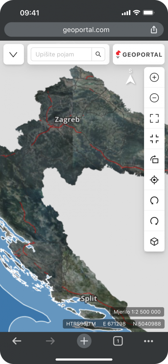
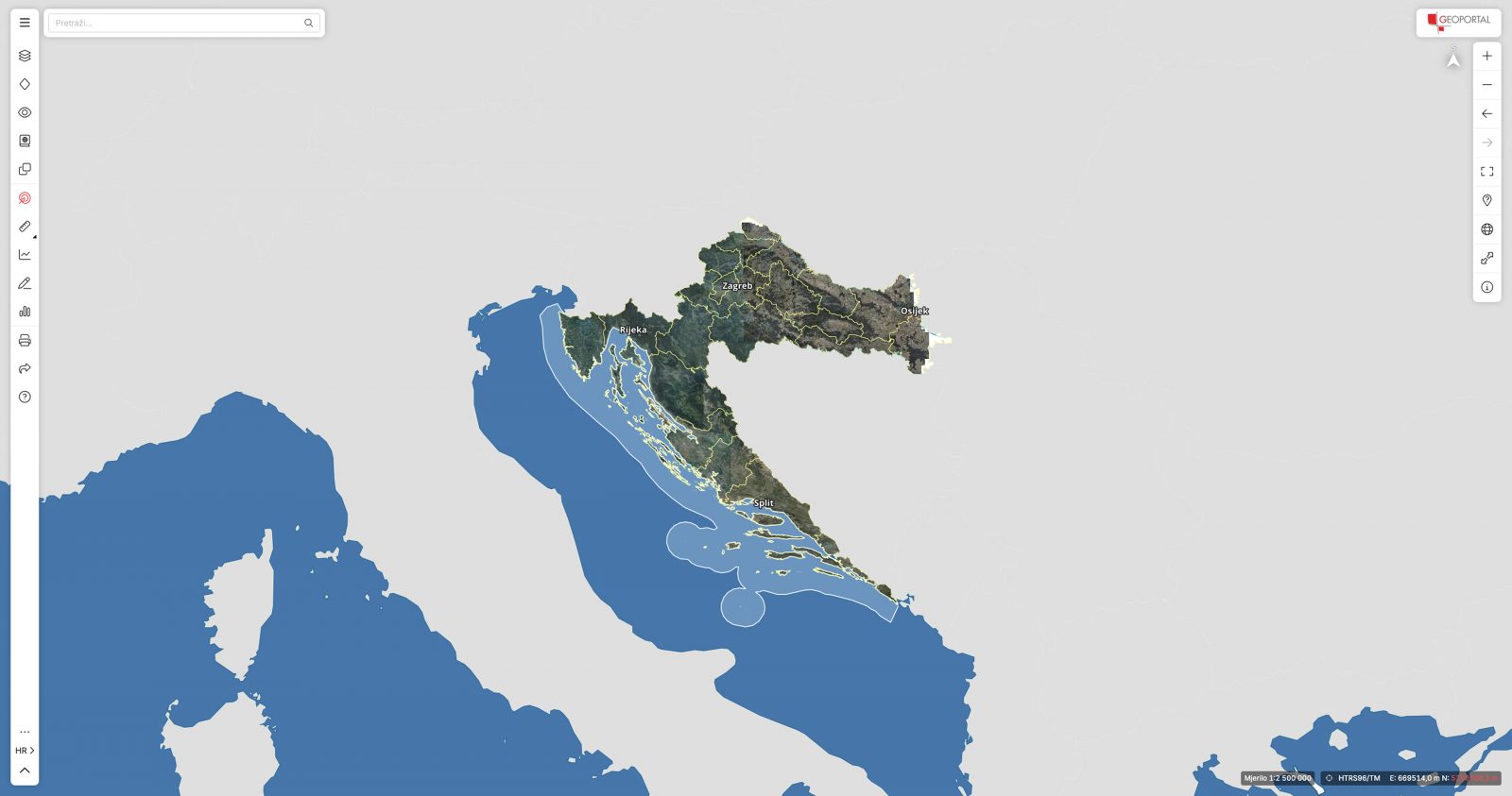
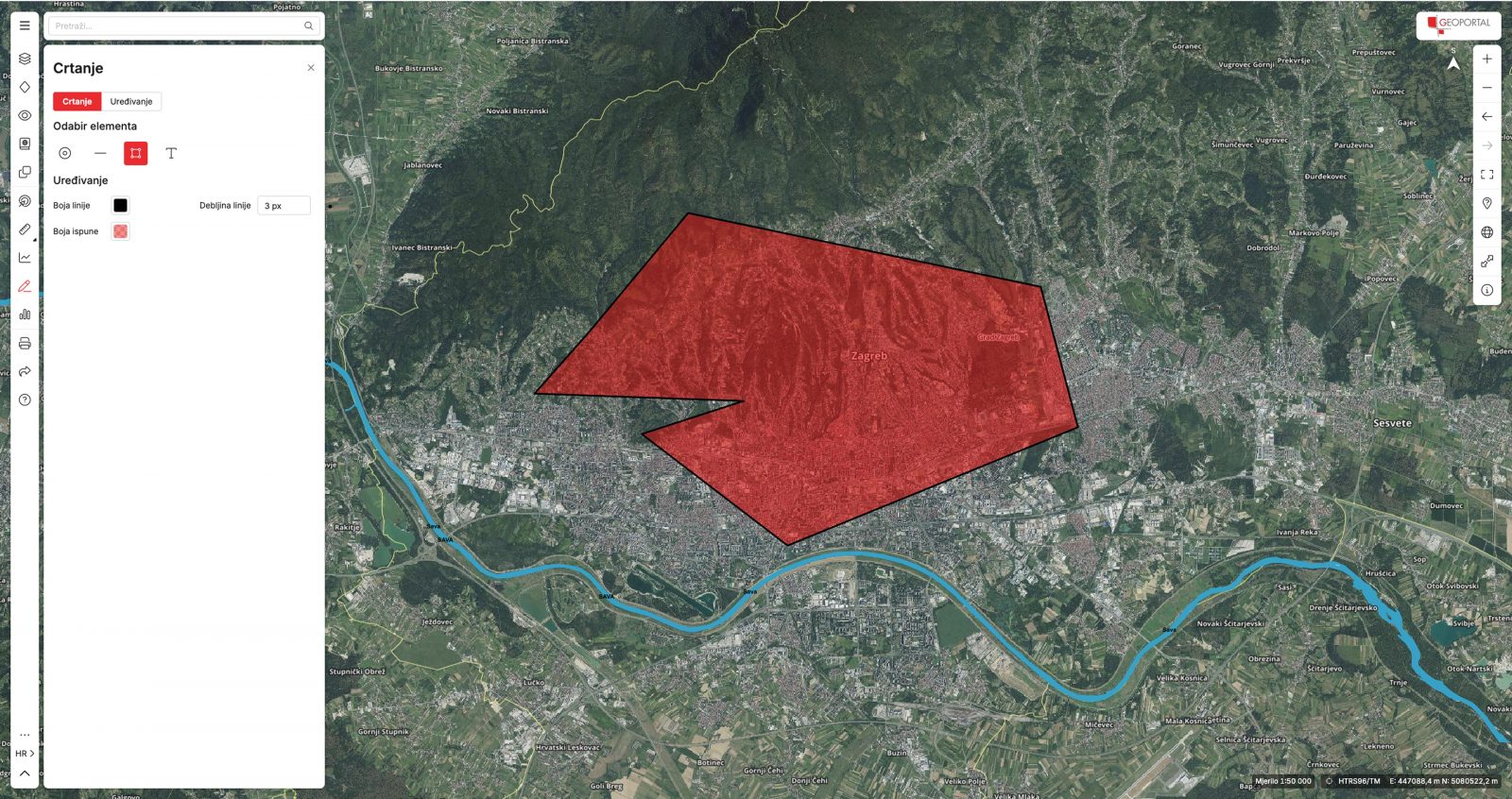
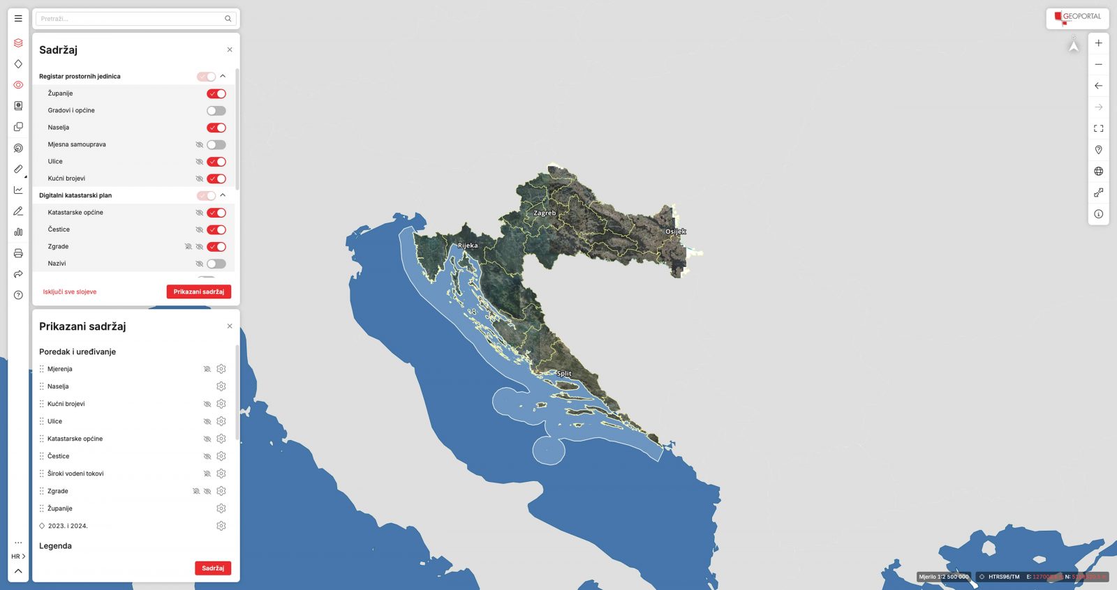
One of the key requirements was to place the map at the centre of the user experience, making it the primary visual and functional element of the application. At the same time, the menu and toolbar needed to remain subtle and unobtrusive, allowing users to interact with the map without unnecessary distractions.
We also paid particular attention to the information architecture and to the way content, functionalities and tools were organised. The goal was to help users easily find the information they need and clearly understand what they find.
Information architecture
“ Information architecture helps people find what they are looking for and understand what they find.
An important aspect of Geoportal is helping users understand and correctly use the tools and options available within the web application so they can quickly reach the information they need.
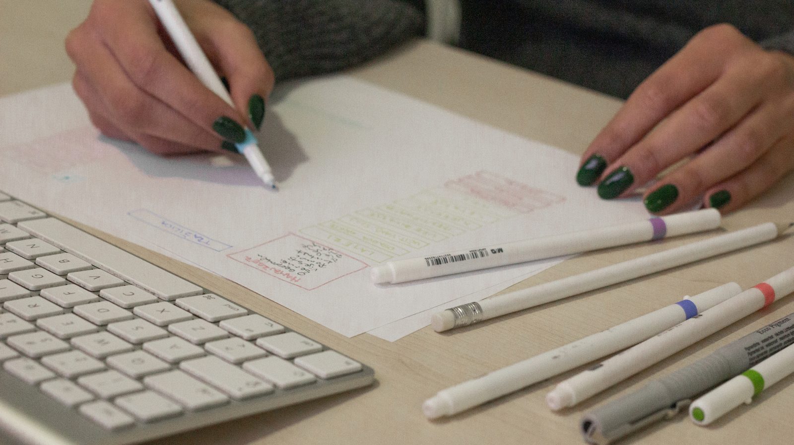
We carried out a detailed analysis of tool groups and functionalities in order to organise them logically and adapt them to users’ needs.
By identifying key tools, grouping them logically, positioning them strategically within the interface and providing clear names and labels, we significantly improved user orientation.
This approach makes the application more intuitive to use, reducing the time needed to find specific options and improving overall efficiency.
Tools and user experience
Alongside standard digital map controls such as zooming in and out, Geoportal provides a range of advanced features.
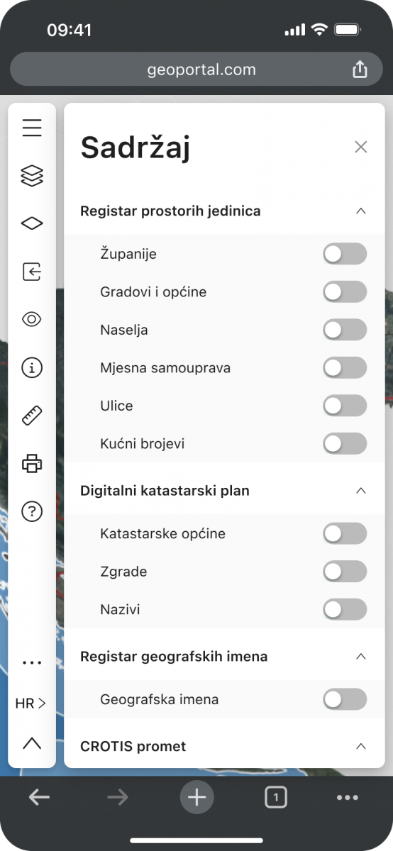
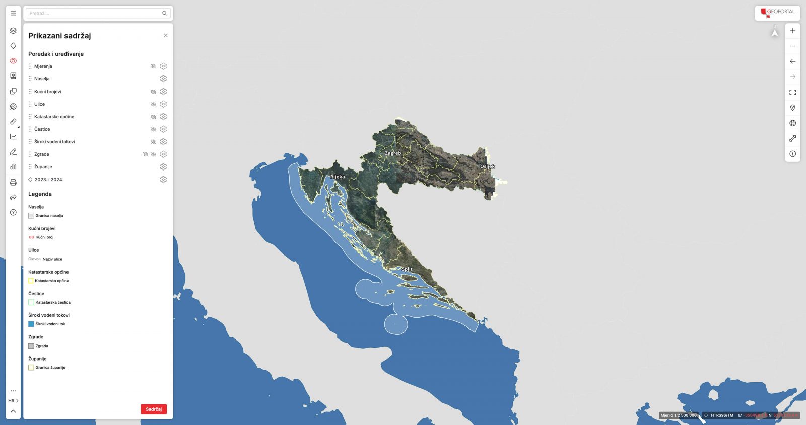
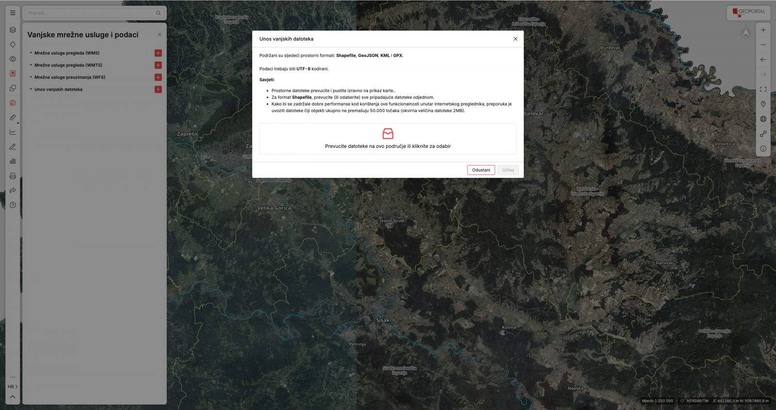
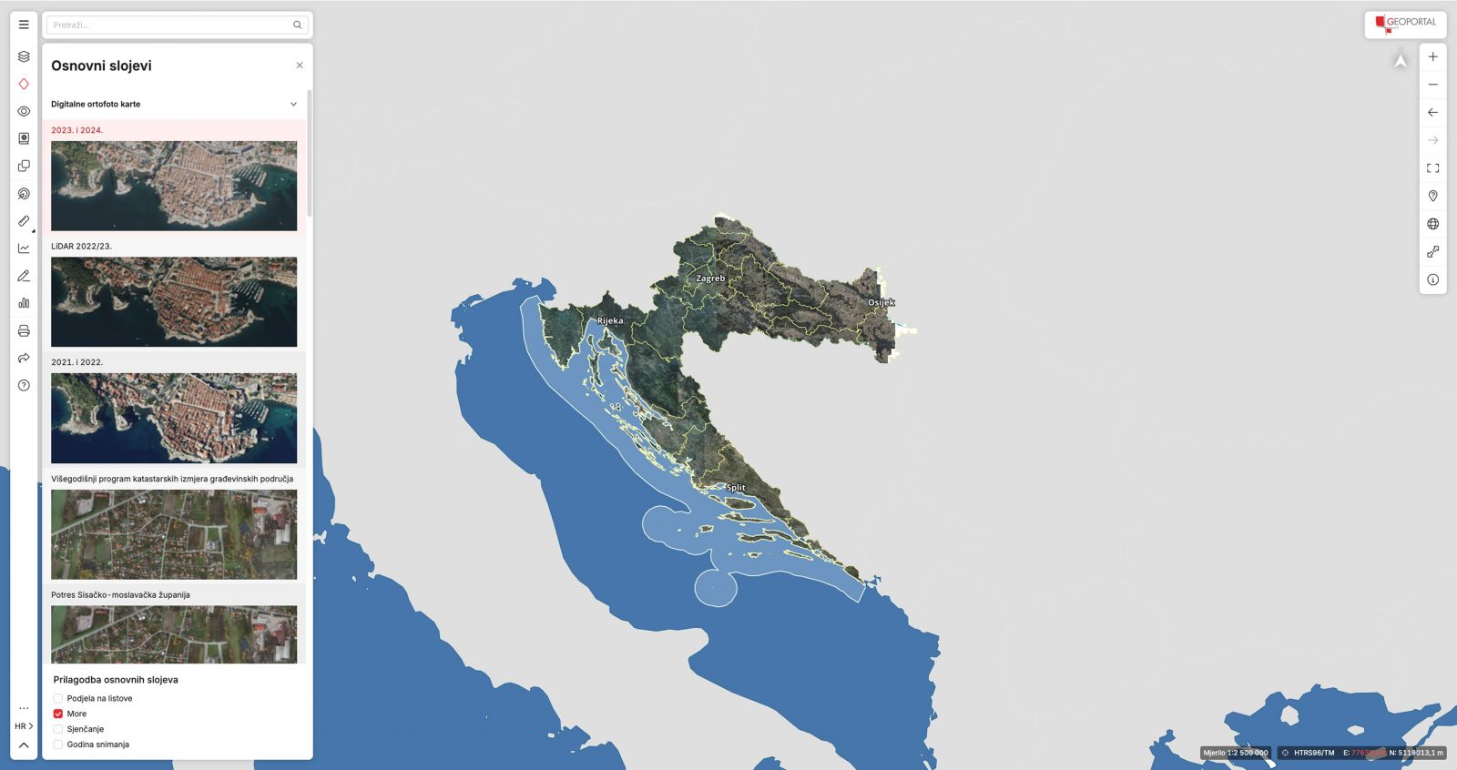
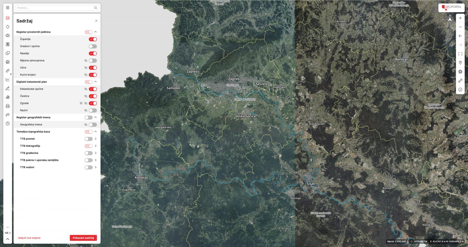
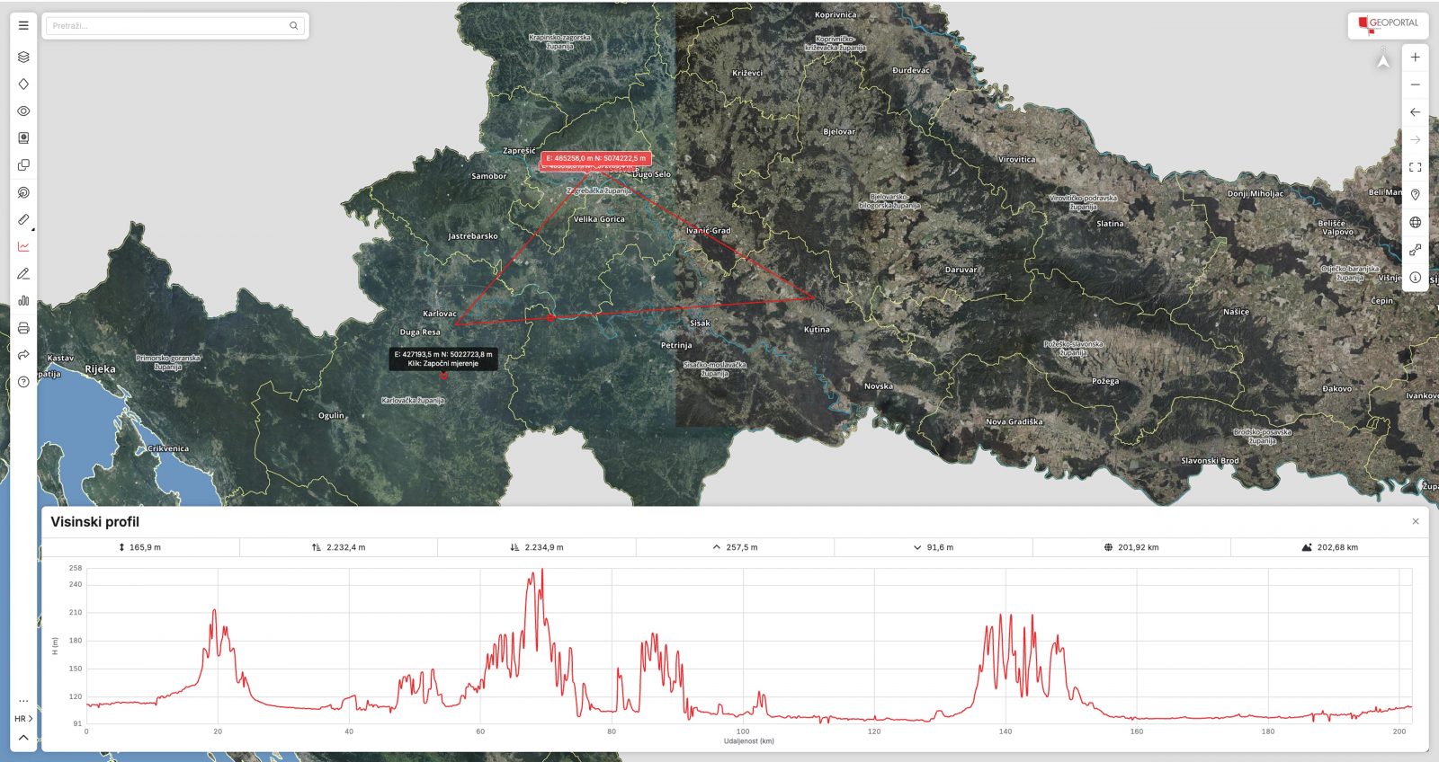
Users can select active and base layers, manage layer opacity and order, display layer legends, load external layers and access additional functionalities.
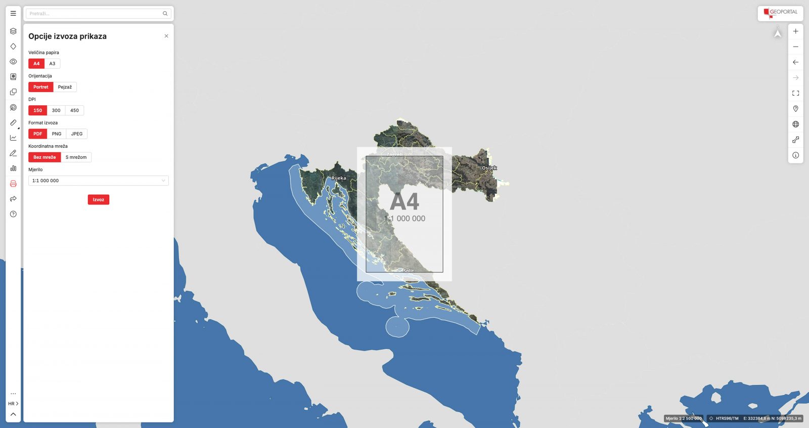
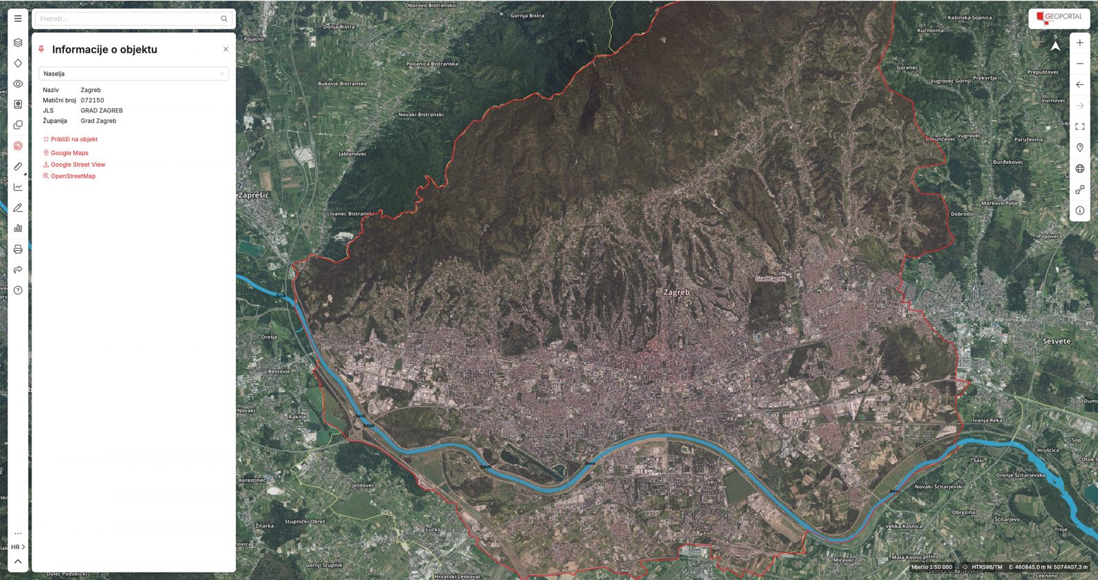
Once the layers have been configured, users can draw, edit, measure, identify and print visible sections of the map and the elements displayed on it.
Geoportal was designed to support different types of users, from beginners to experienced professionals, by providing intuitive tools for every level of expertise.
Every tool and interaction had to be carefully designed so that both beginners and advanced users could use them easily and intuitively.
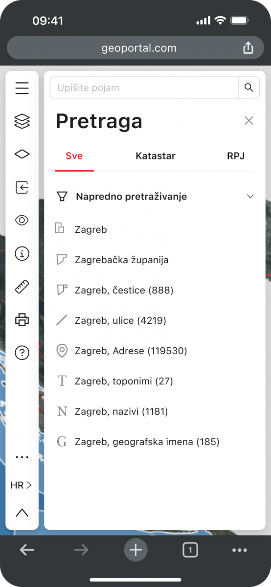
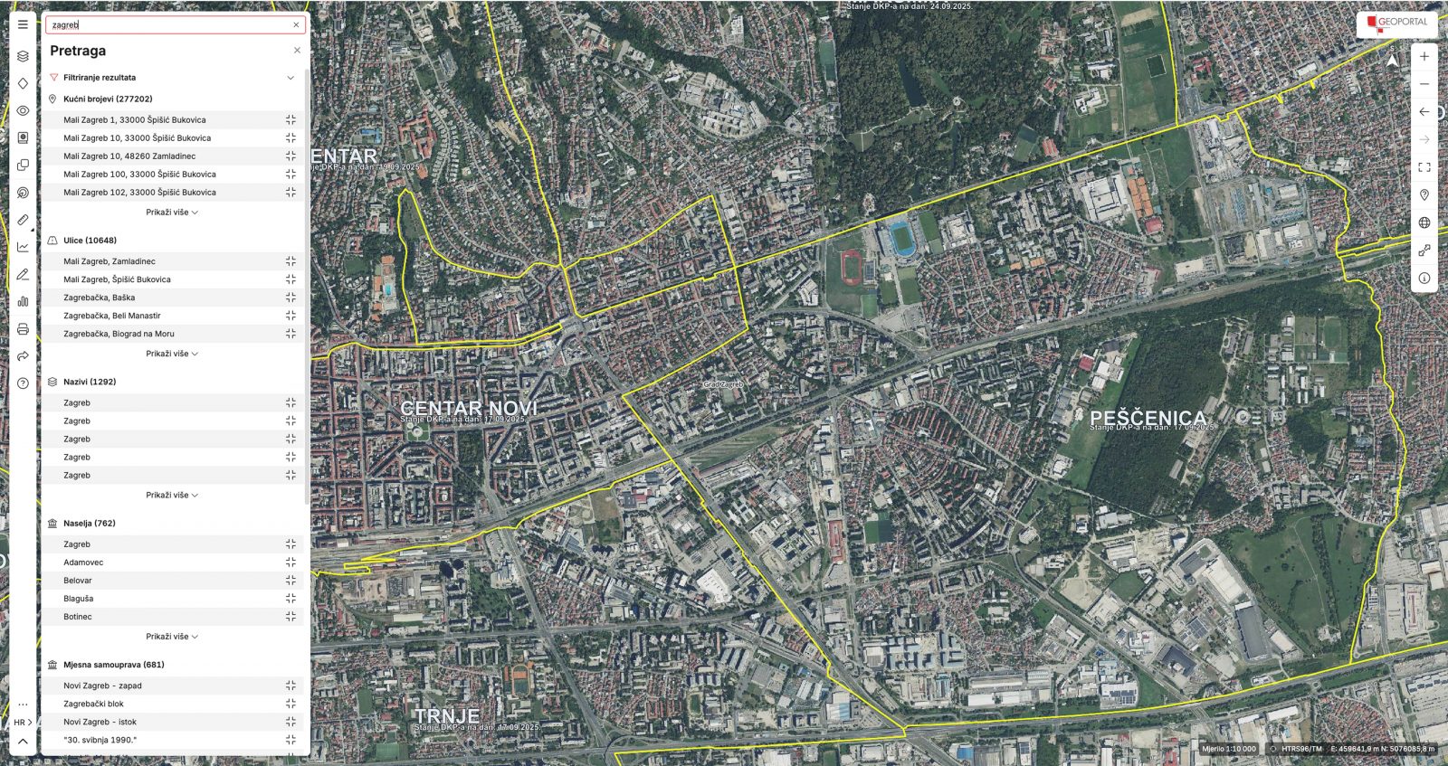
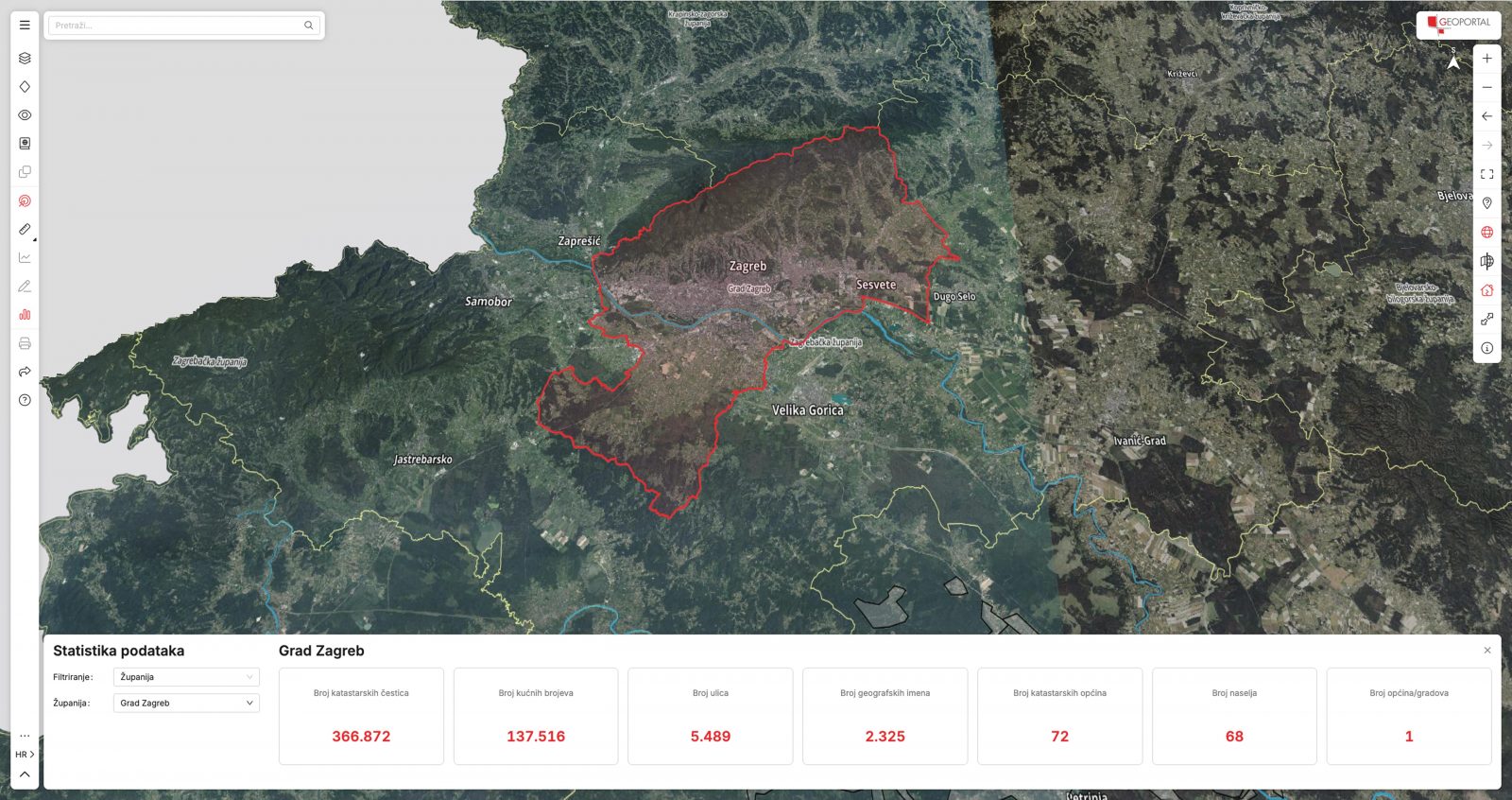
Special attention was given to the search functionality due to the complexity of searching through information and applying filters.
The search was designed with clarity in mind, allowing users to apply different search criteria and quickly narrow down results.
Optimised result loading makes it easier to find relevant information even when working with large datasets.
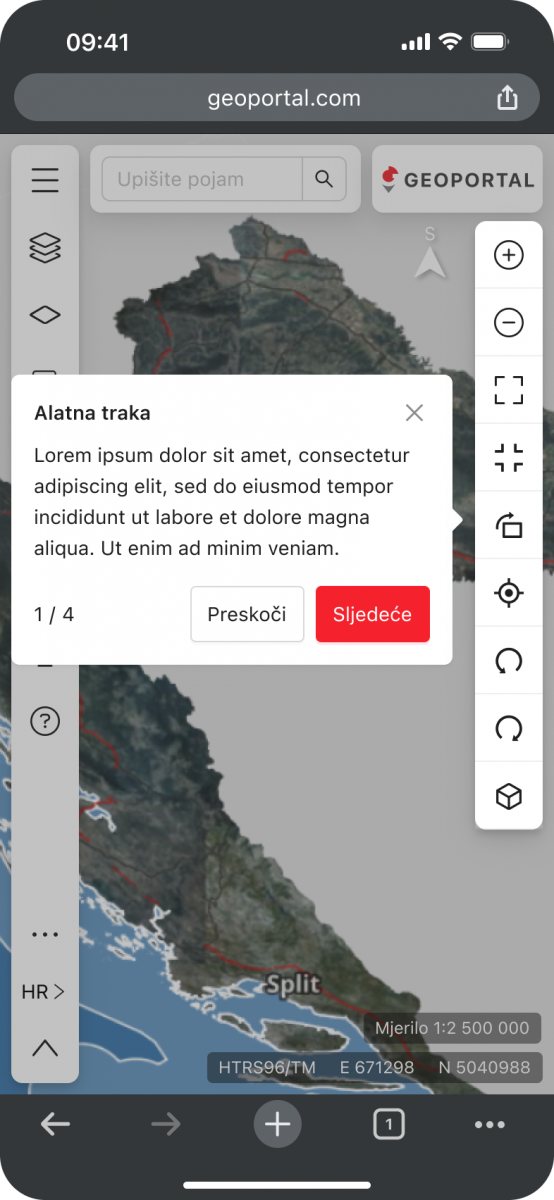
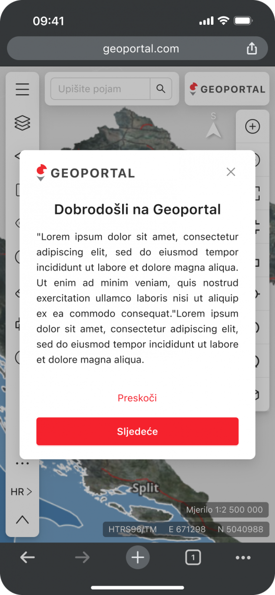
For users accessing Geoportal for the first time, several types of guidance were introduced to make onboarding easier.
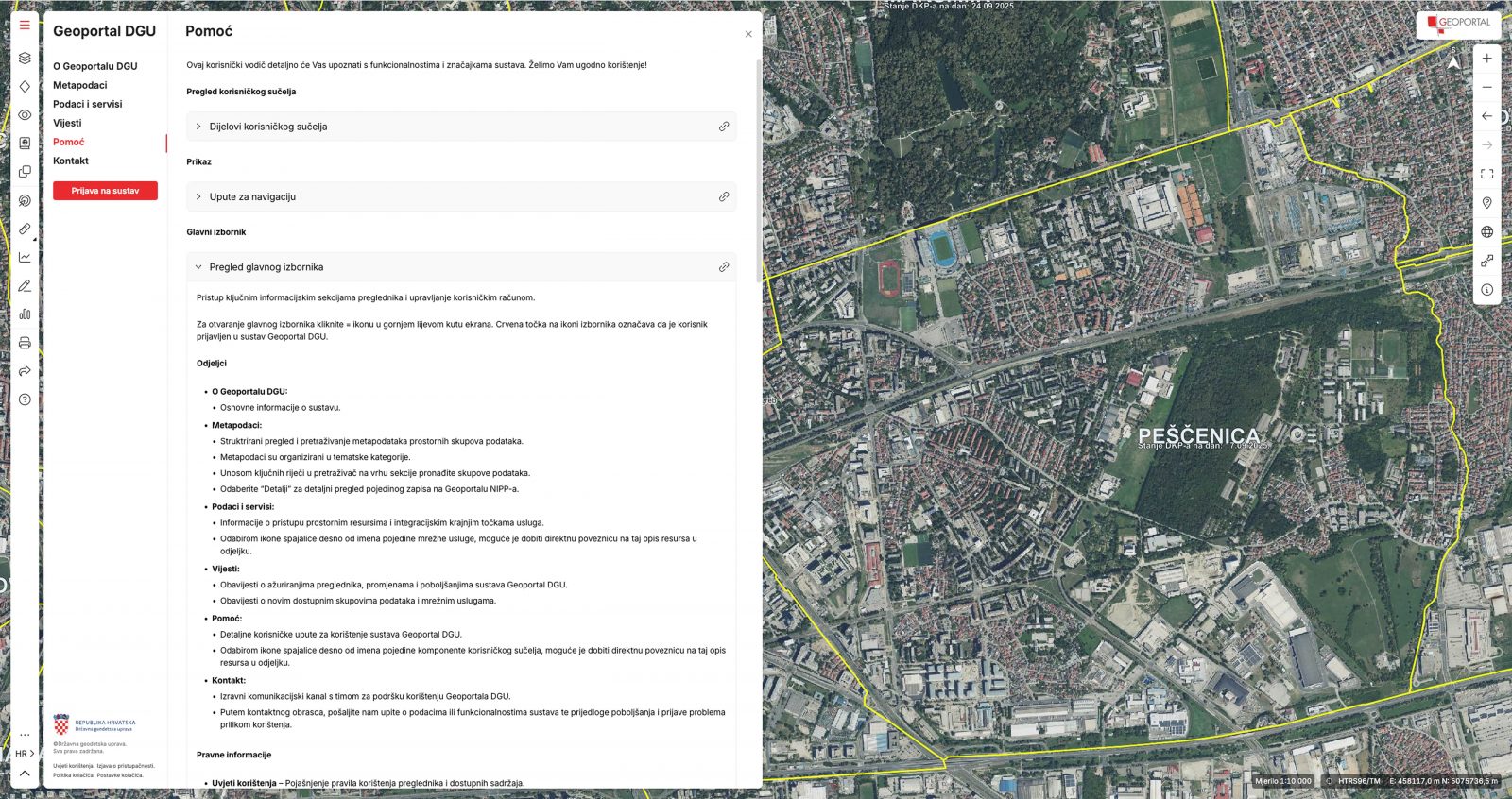
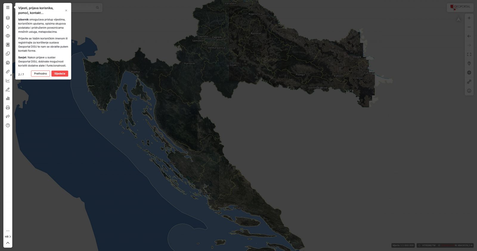
An introductory guide provides essential information and explains the basic steps for using the main functionalities.
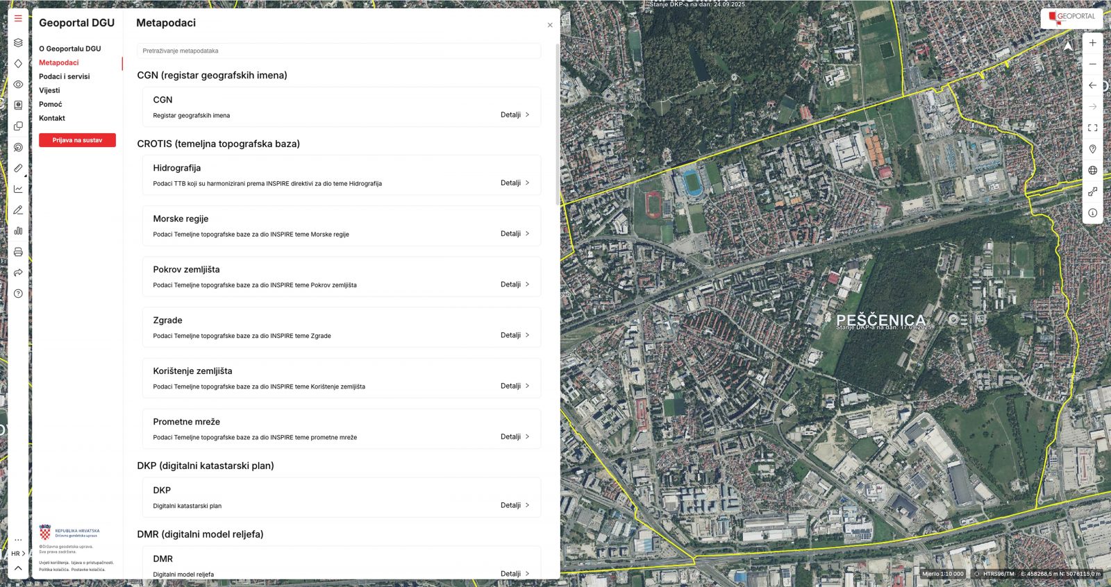
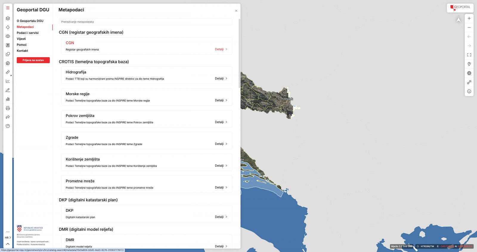
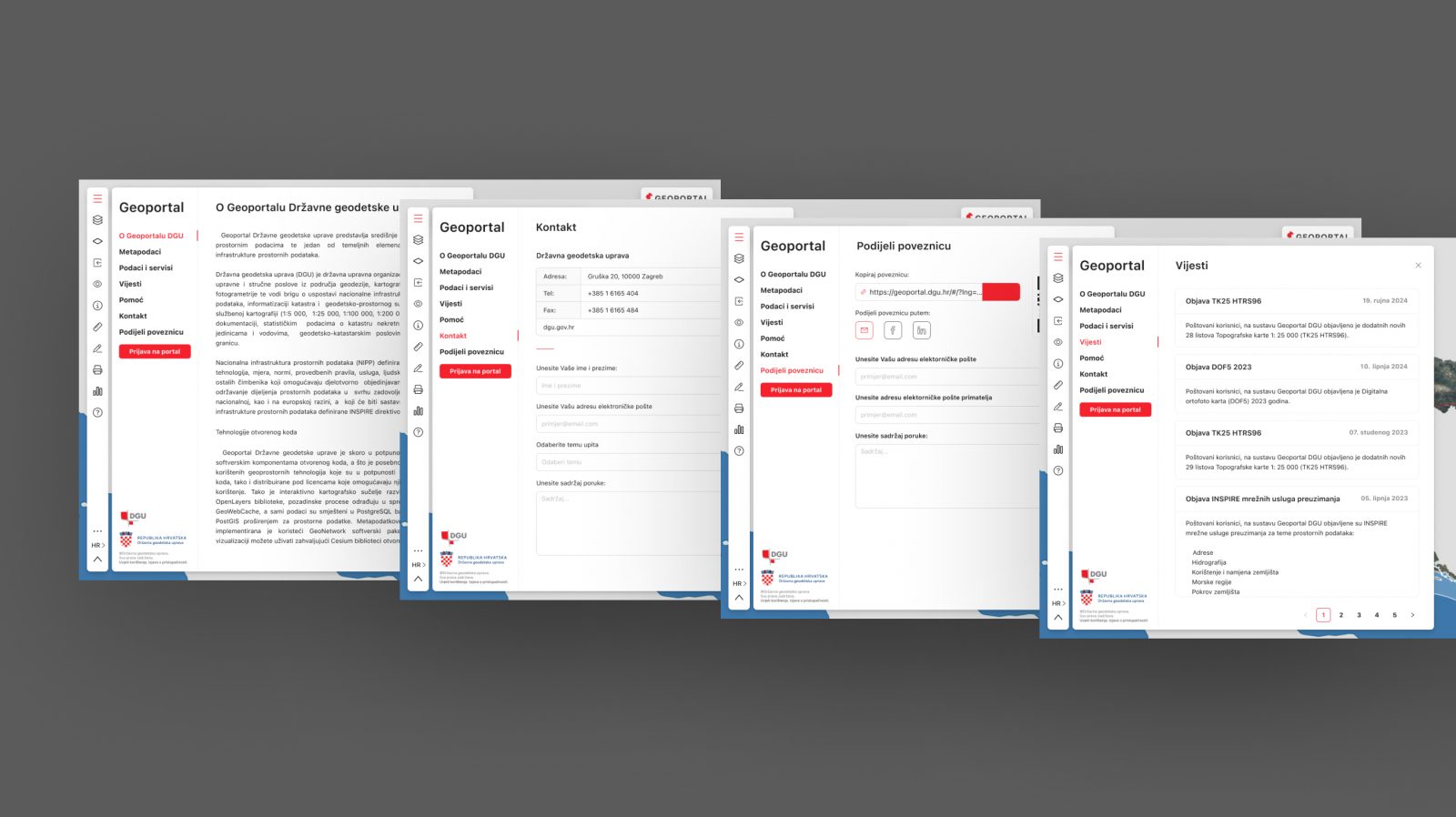
In addition, a detailed text-based guide is integrated into the CMS section of the portal, explaining specific options and system features.
A dedicated help tool also allows users to quickly find answers and instructions for individual functionalities, making the platform more approachable and easier to use for new users.
CMS API integration
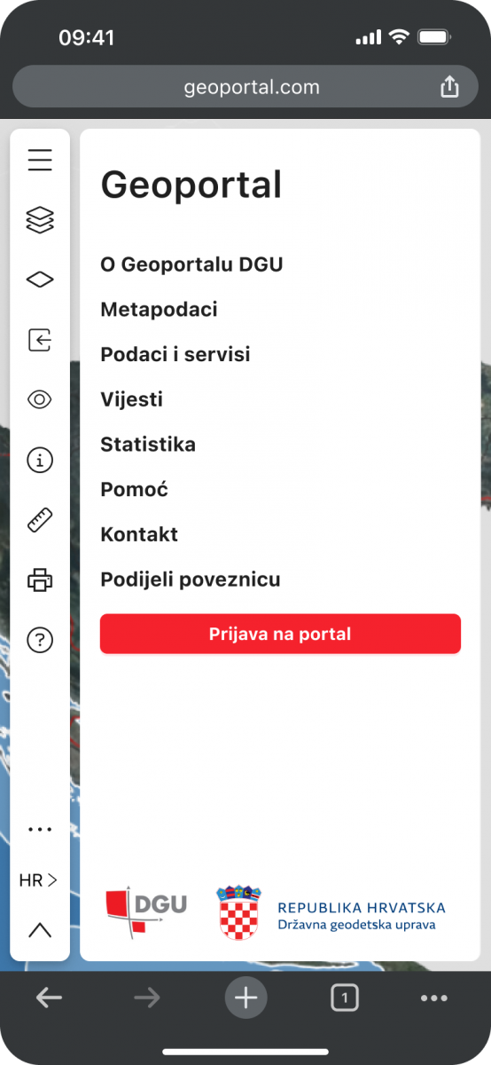
In addition to map management, Geoportal also functions as a traditional website where users can access additional content, latest news, information about available services and functionalities, as well as details about Geoportal itself.
Users can also log in to their profile to access additional options.
From a technical perspective, the CMS section of Geoportal was integrated through API services, enabling efficient communication between different parts of the system.
This approach allows administrators to manage data and content from a single centralised platform without having to switch between different systems.
As a result, the platform is more flexible and easier to maintain, while API services ensure fast and reliable data exchange between the user interface and the back-end system.
User interface
The foundation of the user interface was defined using the Ant Design system, with all components, elements and variables built around it.
Geoportal was developed using Ant Design as the foundation of the interface, helping ensure consistency and a high level of functionality across the application.
One of the client’s main visual requirements was to create a spacious, uncluttered interface with the map as the primary focus.
To achieve this, we developed a concept based on floating interface elements. Toolbars and functional buttons were positioned around the edges and corners of the screen, maximising the available space for the map and further emphasising its importance.
Responsive design
Due to the complexity of Geoportal’s tools, the user interface was specifically adapted for mobile devices.
On smaller screens, drawing and editing functionalities were removed to improve clarity and simplify interaction.
In landscape mode on mobile devices, the number of controls used to navigate the map was reduced even further, taking into account that users typically rely on gestures such as pinch-to-zoom rather than dedicated zoom buttons.
Across all devices, including desktop and mobile, users can also hide the left-hand navigation panel to increase the amount of screen space available for the map.
This functionality is particularly useful on smaller screens, providing easier navigation and a clearer view of the map.
Simplicity through design
When user experience is placed at the centre of the design process, even a complex tool can feel natural to use — Geoportal is now an example of that.